 |
| Credit: NSIDC |
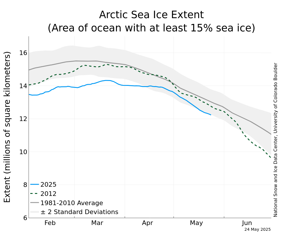
However, I have to wonder if these data were correct in the first place. I find it surprising that there should be such a surge this late in the season. And, coincidentally, this surge occurred at the same time the 2014 IceBridge campaign began. IceBridge is an airborne survey of the sea ice using P-3s flying out of various locations such as Fairbanks, Alaska and Thule, Greenland. It provides very valuable data and is critical for maintaining a continuous record between U.S. ice surveying satellites. Unfortunately, planes being what they are, these flights are limited by weather and seasons.
If we examine the ice temperature we see that it is rapidly warming. Of course, once the temperature reaches the melting point new ice will no longer form and existing ice will begin to melt. This plot, from the Polar Portal, shows the surface temperature for the Arctic region on March 22.
 |
| Credit: Polar Portal |
This plot shows the sea ice extent. You can compare the two to see what the ice temperature is as opposed to the surface temperature of the open water.
 |
| Credit: Polar Portal |
It is pretty clear that the regions at the edge of the ice cover is at, or near, the melting point. The ice extent may not be at the maximum for this year, but should be very close. This all makes me a little skeptical of the ice data for the winter.
I can't prove it, but I think this data may show that we were not able to get enough data during the winter to make as good of an estimate on the ice extent as we would like. Now that Spring has come to the Arctic region and there is sunlight, data from IceBridge and other programs is providing a more complete, more accurate picture. This would mean the surge we have seen the last couple of weeks was not a surge in the amount of ice present, but a surge in the accuracy of our data.
Either way, the situation, while better than before, is still not good. The ice extent, even with the increased level of reported extent, is way below the baseline average. Hopefully, this is not a harbinger of the summer to come.
No comments:
Post a Comment